Log in
All resources
Create a design
947 Free Artworks of Maps Of The Netherlands
gemeente atlas van nederland - south holland
1860s maps of south holland
netherlands in the 1860s
maps by willem and johannes blaeu
atlas van loon
maps of polders in south holland
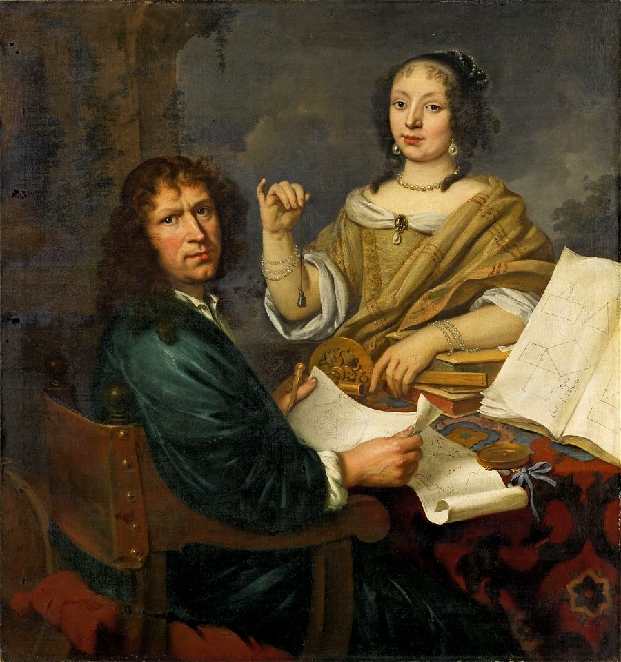
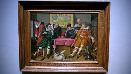
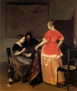
people with maps in art
sconces in the netherlands
maps by isaak tirion
isaak tirion
frederick de wit
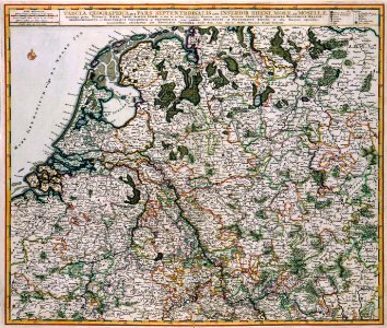
netherlands
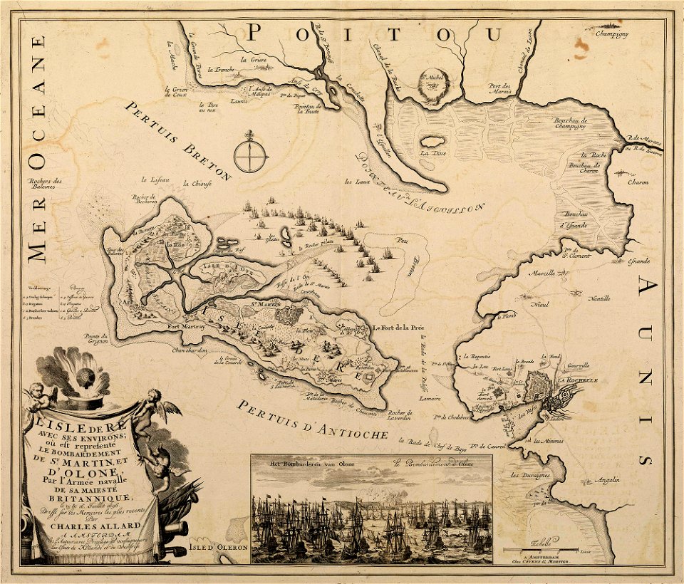
sainte-marie-de-ré
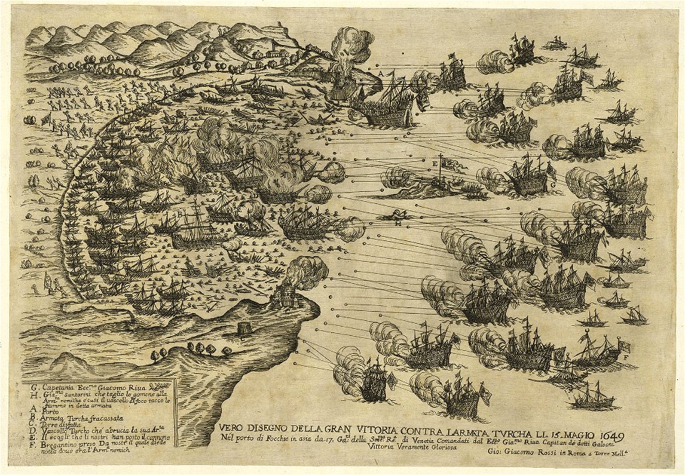
bombardment
fortifications in the netherlands
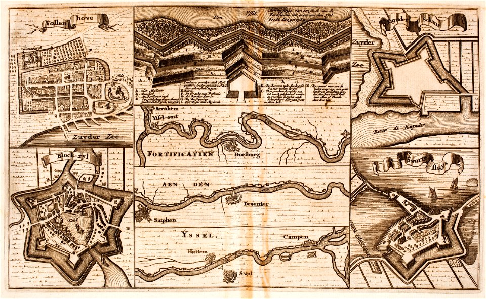
zwartsluis
artworks without wikidata item
17th-century prints
sailing ships of the netherlands
1665
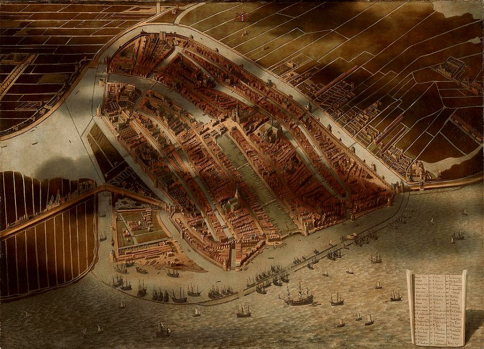
topographical paintings in the amsterdam museum
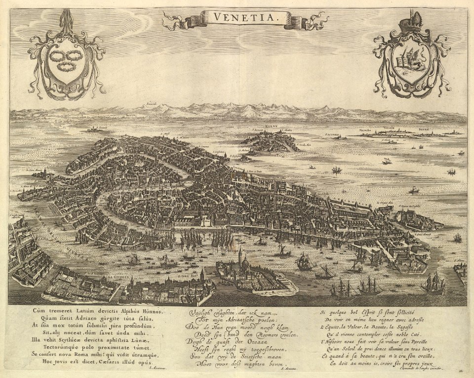
paintings of amsterdam
prints from hugo de groot grollæ obsidio at the peace palace library
1620s maps of the netherlands
topographical paintings in the centraal museum
16th-century paintings in the centraal museum
maps with cartouches
atlas van der hagen
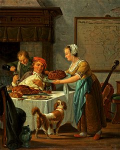
cellos in art
artist
17th-century fortress plans
cityscapes in art
franco-dutch war
netherlands
works by giovanni giacomo de rossi
sailing ships of the netherlands
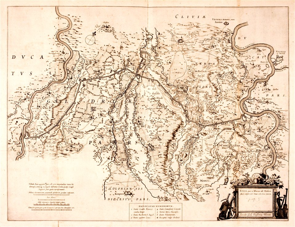
history of rheinberg
history of venlo
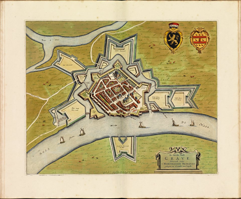
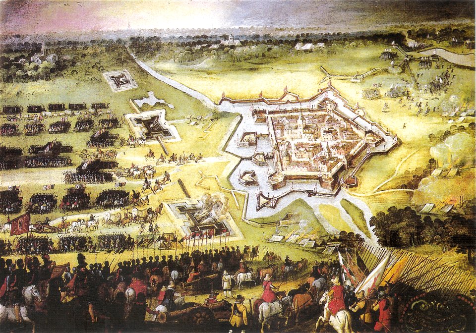
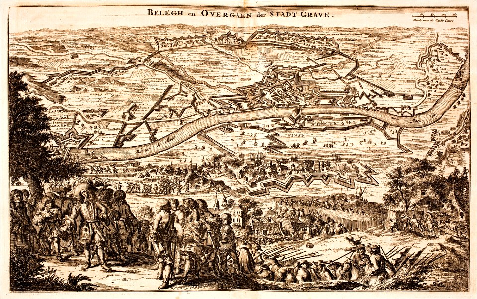
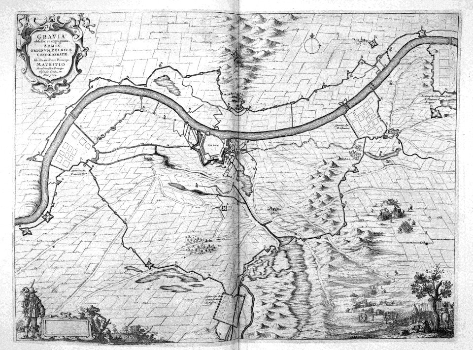
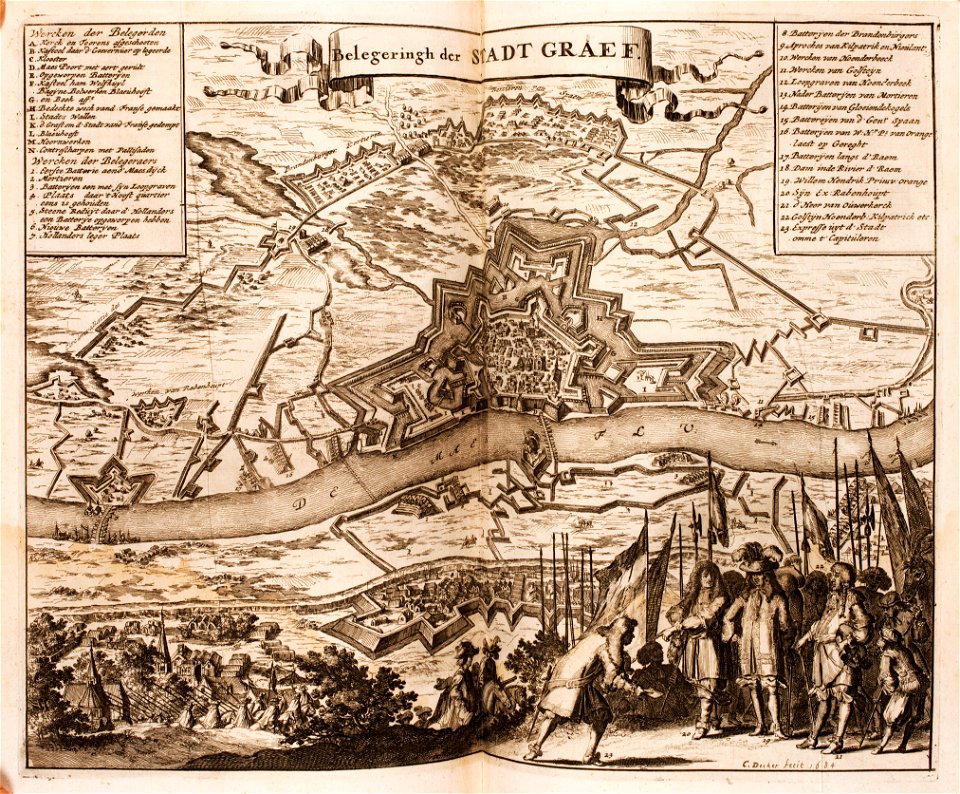
siege of grave 1602
netherlands
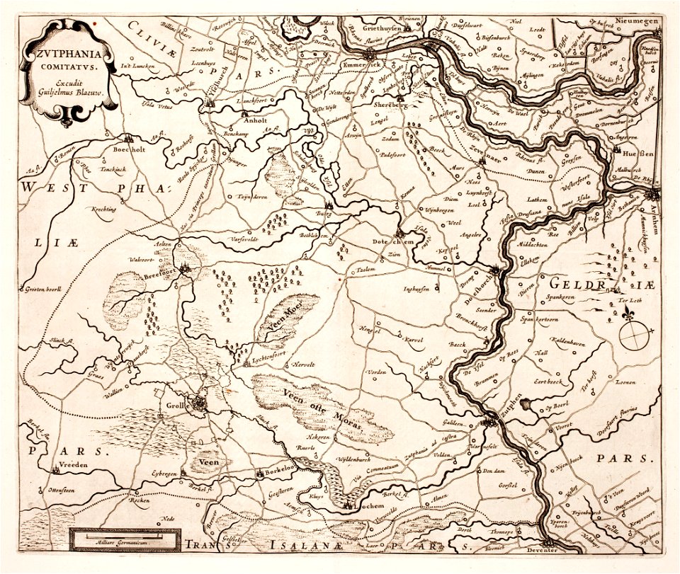
zutphen
ijssel
topographical paintings in the amsterdam museum
paintings of amsterdam
17th-century allegorical paintings
artist
works by giovanni giacomo de rossi
sailing ships of the netherlands
franco-dutch war
netherlands
maps by willem and johannes blaeu
17th-century fortress plans
1760s maps of the netherlands
old maps of south holland
maps by willem and johannes blaeu
atlas van loon
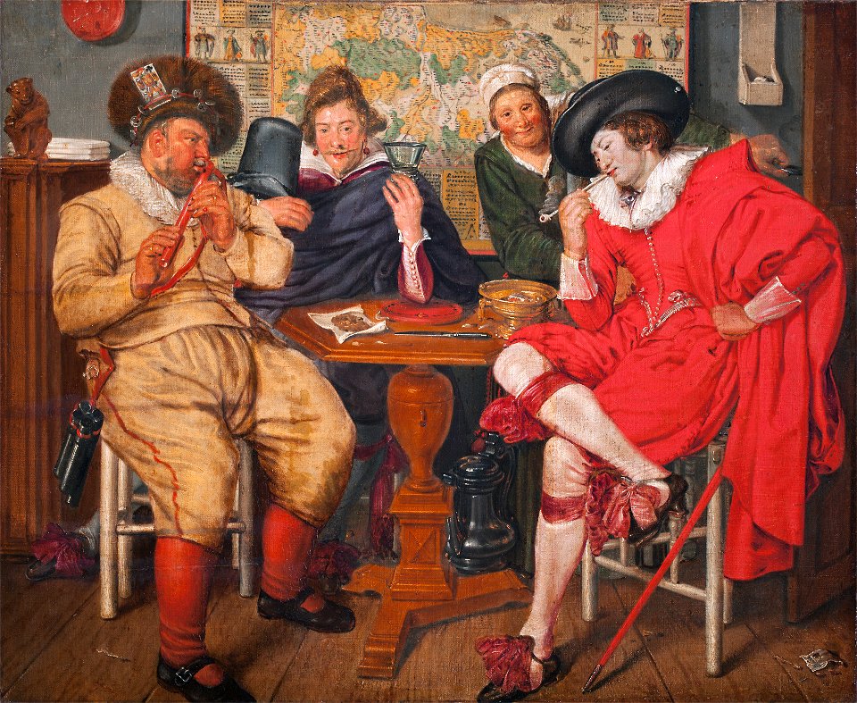
oil paintings of people
smoking men in art
people with fire in art
people with dog
17th-century maps of the netherlands
1609
17th-century oil on canvas paintings in the netherlands
male fur clothing in art
17th-century oil paintings of standing women at full length
17th-century paintings of people with dogs
maps by jacques-nicolas bellin
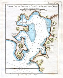
old maps of saint lucia
portrait paintings of men holding baton
19th-century cabinet portraits
maps by christian sgrothen
maps of erkelenz
maps of the united kingdom of the netherlands
françois bohn
old maps of the united states
copper engravings
maps in the library of congress
adriaen van der donck
maps of nieuwkoop
aarlanderveen
gemeente atlas van nederland - south holland
maps of alblasserdam
maps by christian sgrothen
maps of erkelenz
gemeente atlas van nederland - south holland
maps of zoeterwoude
gemeente atlas van nederland - south holland
1860s maps of south holland
gemeente atlas van nederland - south holland
maps of peursum
gemeente atlas van nederland - groningen
maps of winschoten
1730s maps of the netherlands
1730 maps
1740s maps of the netherlands
maps of borculo
19th-century maps of south holland
maps of veur
gemeente atlas van nederland - gelderland
netherlands in the 1860s
maps by willem and johannes blaeu
old maps of middelburg, zeeland
carel herman aart van der wijck
louis storm van 's-gravensande
maps of avesnes-sur-helpe by braun & hogenberg
frederick de wit
1602 in the netherlands
siege of grave 1602
adriaan justus enschedé
old maps of haarlem
maps by willem and johannes blaeu
siege of breda 1624-1625
gemeente atlas van nederland - utrecht
old maps of amersfoort
gemeente atlas van nederland - south holland
maps of noordeloos
gemeente atlas van nederland - limburg
19th-century maps of maastricht
maps of waterways in the netherlands
maps of nieuwe merwede
maps of nieuw nederland
nicolaes visscher ii
gemeente atlas van nederland - groningen
maps of appingedam
maps from university of amsterdam special collections
atlas der neederlanden
1866 in the netherlands
maps of almelo
maps by cornelis anthonisz.
1560 maps of europe
gemeente atlas van nederland - south holland
maps of zuidland
sieges of the eighty years' war
conflicts in 1583
dutch 18th-century paintings in the rijksmuseum amsterdam
august christian hauck
1590s maps of the netherlands
1590s maps of belgium
gemeente atlas van nederland - friesland
19th-century maps of friesland
gemeente atlas van nederland - utrecht
maps of houten
maps made in the 17th century
forts in the netherlands
bodleian maps collection
leo belgicus
gemeente atlas van nederland - gelderland
maps of ophemert
old maps of gelderland
old maps of zutphen
seventeen provinces
1664 maps
maps by willem and johannes blaeu
atlas van loon
nicolaas samuel crucquius
old maps of delfland
nicolaas samuel crucquius
old maps of delfland
gemeente atlas van nederland - south holland
maps of heenvliet
gemeente atlas van nederland - south holland
1860s maps of south holland
gemeente atlas van nederland - south holland
1860s maps of south holland
maps of polders in south holland
old maps of vlaardingen
gemeente atlas van nederland - south holland
1860s maps of south holland
1673 in new york city
24 august
maps of aa en hunze
anloo
maps of landgraaf
rimburg
atlas van loon
1664 maps
atlas maior, vol 4 (netherlands) - joan blaeu, 1667 - bl 114.h(star).4
1667 maps
gemeente atlas van nederland - overijssel
netherlands in the 1860s
gemeente atlas van nederland - friesland
old maps of leeuwarden
gemeente atlas van nederland - north holland
maps of aalsmeer
maps of rotterdam by berckenrode
atlas van loon
gemeente atlas van nederland - groningen
old maps of groningen (city)
gemeente atlas van nederland - south holland
maps of heerjansdam
siege of zaltbommel 1599
1599 in the netherlands
lawrence h. slaughter collection of english maps, charts, globes, books and atlases
de nieuwe en onbekende weereld
maps by willem and johannes blaeu
coats of arms on maps
copper engravings
old maps of goes
gemeente atlas van nederland - south holland
1860s maps of south holland
old maps of limburg, netherlands
old maps of gelderland
gemeente atlas van nederland - south holland
maps of abbenbroek
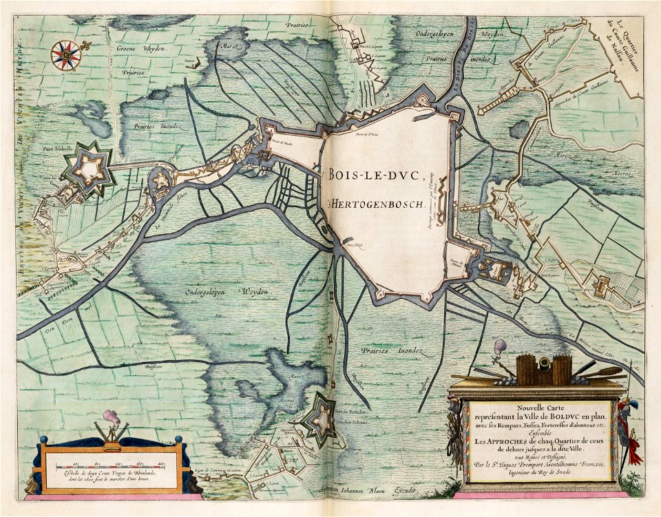
old maps of 's-hertogenbosch
empel en meerwijk
maps of the duchy of limburg
1645 maps of belgium
maps of lichtenvoorde
house of bronckhorst
101 - 200 of 947
Next page
/ 10


![[Map of the Netherlands as 'Leo Belgicus' by Nikolaus Visscher, 1648], Nicolaes Visscher](https://cdn.creazilla.com/illustrations/10000445798/map-of-the-netherlands-as-leo-belgicus-by-nikolaus-visscher-1648-nicolaes-visscher-md.jpg)


